Tech Meets Tide: Know about NASA's New Finding; Ocean Robots to Fight Sea Level Rise
- Soham Halder
- 1 year ago
- 4 minutes read

Scientists are trying to understand the changes in Antarctica’s ice shelves and their impact on sea level rise.
Accelerated by climate change and global warming, the water levels in oceans across the globe are increasing. Across the U.S. coastline, the projected sea level rise is around 10 - 12 inches (0.25 - 0.30 meters) during 2020 - 2050. Shockingly, the same amount of sea level rise was observed during 1920 - 2020, indicating a rapid change in atmosphere. From infrastructure to water and oil extraction, every sector will face the consequences of drastic sea level rise. To combat this, NASA scientists came up with an innovative approach. In this article, we will discuss about this state-of-the-art technology.

Ocean Robots:
A group of NASA rocket scientists develped ‘autonomous underwater robots’ capable of diving beneath Antarctica’s humongous ice shelves, where humans cannot go and collect data. These robots are 8 feet long and 10 inches in diameter. The main task of the robots will be collecting data about rapid ice melting and analyzing the catastrophic impact.
As a first step of “IceNode” mission, NASA’s Jet Propulsion Laboratory scientists deployed cylindrical robot into the icy waters of the Beaufort Sea north of Alaska to collect 100 feet underwater data in March, 2024. After the successful pilot scale study, scientists are planning to send a fleet of robots, which will be latched on Antarctica ice shelves for long periods.
How Robots will Work?
“We’ve been pondering how to surmount these technological and logistical challenges for years, and we think we’ve found a way,” mentioned Ian Fenty, a climate scientist at JPL, who is also the project lead of IceNode.
Autonomous underwater robots helping to better predict global sea level rise? Meet IceNode! 🧊
— NASA JPL (@NASAJPL) August 29, 2024
This project could one day help scientists calculate the melt rate of Antarctic ice shelves, gathering data in one of the most inaccessible places on Earth. https://t.co/txQHClaG1O pic.twitter.com/zdF2Nl4PU6
(Credit - @NASAJPL X handle)
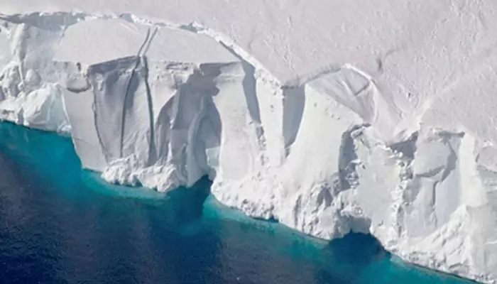
Scientists previously detected the spot for rapid ice melting which is known as “grounding line”. This is the area where glacier rises from the seabed to shape into an ice shelf.
One scientist associated with the reasearch team explained the reason behind rapid melting as “warm ocean water eats away at the ice from underneath”.
NASA is planning to deploy at least 10 IceNode robots, which will reach destination swiming through ocean currents, monitored by specially designed software. After reaching there, the robots will spread out their ‘landing gear’ or attachment structures to the ice.
According to NASA, robotic sensors will monitor the rate of ice melting along with “how quickly the cold meltwater is sinking”.
When the monitoring period will be over, the robots will automatically detach from the ice. This will be followed by drifting to the surface of the ocean while transmitting data by satellite. The collected data will be analyzed by scientists using computer models.
Unparalleled views of sea level rise ⬆️🌊🛰
— NASA Climate (@NASAClimate) June 27, 2024
Global sea levels have risen more than 4 inches (102 millimeters) since measurements began in 1992, increasing coastal flooding in some places. Learn more: https://t.co/3AlxV8yHei pic.twitter.com/QuGbB3ls7p
(Credit - @NASAClimate X handle)
This is not the first time when scientists are deploying robots to observe ice sheets in Antarctica. Scientists from Cornell University have previously sent torpedo-like robot named ICEFIN to observe ocean saltiness, heat, and currents. However, the major difference between ICEFIN and newly developed IceNodes is autonomous model of the later one. Another key difference is real time data collection via ICEFIN, while IceNode will be capable of sending the data after completion of the mission.
The IceNode robots are capable of operating one year at a stretch. “These robots are a platform to bring science instruments to the hardest-to-reach locations on Earth,” said Paul Glick, JPL robotics mechanical engineer and IceNode principal investigator.


