Gujarat Floods: How Technology Can Be Effectively Used To Predict And Mitigate Flooding
- Gurpreet
- 1 year ago
- 3 minutes read

The torrential rains in Gujarat have claimed 26 lives over the past three days and around 18,000 people have been evacuated from hard-hit areas.
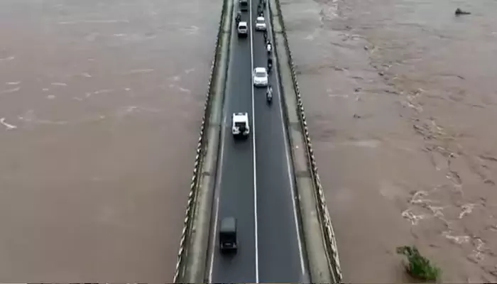
Gujarat continues to grapple with a massive flood situation due to the continuous heavy rainfall in the state. In fact, the India Meteorological Department (IMD) issued a ‘red’ alert for Gujarat, and it is expected that the deep depression over Saurashtra and Kachchh will intensify further and move towards the northeast Arabian Sea. While rescue operations and evacuations are underway, the death toll in rain-related accidents in the state has jumped to 28 in the last three days.
Meanwhile, according to IMD, extremely heavy showers are expected to continue in 12 districts, which include Kachchh, Devbhoomi Dwarka, Jamnagar, Morbi, Surendranagar, Rajkot, Porbandar, Junagarh, Gir Somnath, Amreli, Bhavnagar, and Botad. Nonetheless, to save and rescue lives, six contingents of the Army have been deployed to assist the 14 National Disaster Response Force (NDRF) along with 22 State Disaster Response Force (SDRF) teams.
 teams..webp)
Role Of Technology In Flood Management
However, it cannot be ruled out that technology too can play an important role in predicting and mitigating flooding, specially in current flood-like areas in Gujarat. Check out technology that can be effectively used to do so:
Remote Sensing and Satellite Imagery:
Satellites can be used to assess real-time data on weather patterns, rainfall, and river levels, which in turn, can be early warning signs that predict potential floods. In fact, with the use of high-resolution satellite images, detailed maps of flood-prone areas can be created, which can be used for evacuation purposes.
Weather Forecasting Models:
With the use of weather forecasting models using data from satellites, extreme weather events that could lead to flooding can be predicted.
AI and Machine Learning:
Weather forecasting models can be further enhanced with the use of Artificial Intelligence (AI) in order to improve accuracy in predicting weather-related flooding. With AI, large datasets can be analysed and be used in identifying patterns.
Hydrological And Warning Models:
Hydrological models, which assess how rainfall affects river flows and drainage systems, can predict different levels of precipitation. Apart from that, Geographic Information Systems (GIS) can manage floodplain zoning, and thereby can be used in implementing automated alert systems. They can be used to send warnings to communities via text, email, or sirens. Apps can be developed to provide real-time flood alerts, safety information, and emergency instructions. Using real-time data, water levels in dams and reservoirs can be managed efficiently, in order to avoid potential overflows.
Urban Planning
It is imperative that constructing infrastructure that can withstand floods should be a priority, including elevated buildings, flood barriers, and better drainage systems. They can lower flood risk and manage stormwater effectively.
Post-Flood Analysis and Recovery:
With the use of drones and aerial imagery, damage due to floods can be assessed quickly, which further aids in recovery efforts and reducing the impact on communities overall.


.webp)
